Get Your Canada Boating
License Today!
Anyone operating a motorized pleasure craft on Canadian waters is required to take a Transport Canada-Approved Boater Safety Course and obtain a Pleasure Craft Operator Card (PCOC). Start your course and go boating today with BOATERexam®, a delegated provider for Transport Canada.

Get Your Canada Pleasure Craft Operator Card In 3 Easy Steps

Register For The Boater
Safety Course
Sign up for a BOATERexam® account, pay for the official course, and get started. It only takes a few minutes!

Complete The Online
Course
Take the course on any device. We’ll automatically save your progress so you can learn at your own pace.

Print Your Temporary PCOC
And Go Boating!
Once you pass the online exam, you can print a temporary license and go boating immediately!
Go Boating In Canada Today!
With 208,080 km of coastline, Canada is home to more coastline than anywhere else in the world. With the Pacific Ocean to the west, the Atlantic Ocean to the east, the Arctic Ocean to the north, and the Great Lakes to the south — not to mention 31,752 lakes larger than three square miles — the boating options are truly endless in Canada.
Look for the best places to boat in: Alberta, British Columbia, Manitoba, New Brunswick, Nova Scotia, Ontario, Saskatchewan, Newfoundland and Labrador, Northwest Territories, Nunavut, Prince Edward Island, Quebec, Yukon
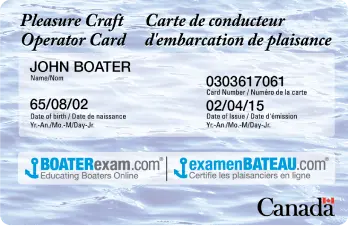
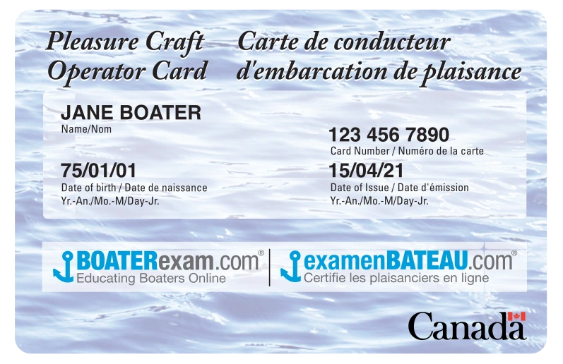
Who Needs A Pleasure Craft Operators Card (PCOC) in Canada?
Anyone operating a motorized pleasure craft in Canada is required to obtain proof of education from a Transport Canada-approved course.
Learn Boat Safety
Relax in your captain's chair as our animated videos teach you how to be a safe boater. Print your temporary PCOC today with successful completion of final exam.
Official Canada Boat Safety Course
Get your Canadian Boat License and learn safe boating habits with lessons like:
- Boating Terms & Definitions
- Required Safety Equipment
- Avoiding Collisions
- Flares & Distress Signals
- Lateral Markers & Buoys
- Waterways Marking System
- Docking & Mooring
- Anchoring
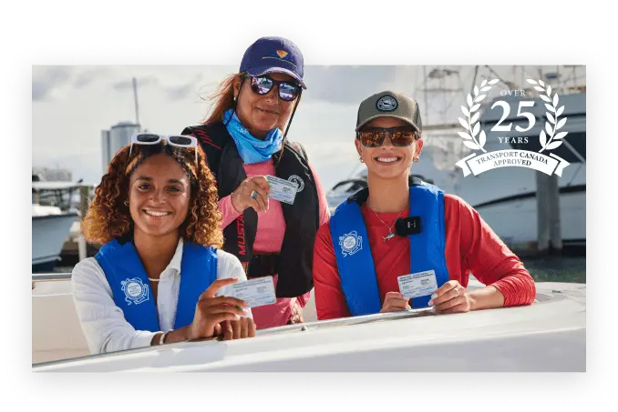
Over 5,000,000 boating students certified and counting:
BOATERexam.com has a TrustPilot rating of 4.7 out of 5 based on 17707 ratings and reviews.
Transport Canada-Approved.
Trusted Nationwide.
BOATERexam.com® is Canada's most trusted provider of boating safety education. Our official boater safety course is approved by Transport Canada and recognized by all 50 U.S. States.
Get Certified
1 extra card: $19.95 + tax
Lost boating license? Need extras?
Order a replacement card in just a few clicks at ilostmycard.com
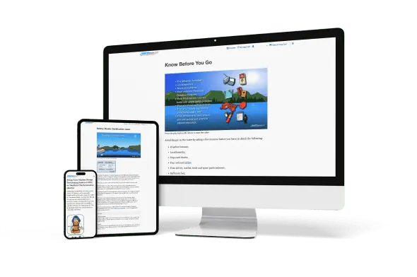
Order NowTake Our Official Boater Safety Course On Any Device
Laptop, tablet, or smartphone — where and when you complete your official boater safety course is completely up to you!

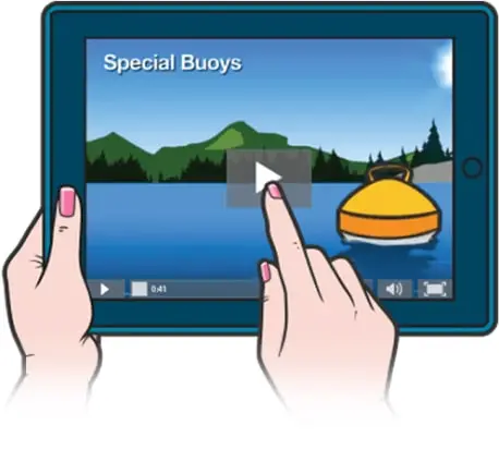
Illustrated Questions For Visual Learners
We realized a long time ago that people learn best when they can see what they're learning. That's why we illustrate every one of our quiz questions — so you can get your Canada Boat License with ease.
Get CertifiedHundreds Of Engaging Videos
BOATERexam.com® takes you out of the textbook and puts you in the captain's seat. Our official boater safety course features tons of dynamic content, including hundreds of interactive and narrated animations. That means you aren't just reading through the exam; You're listening, watching, and engaging — which means you'll retain more and be a smarter, safer boater.
To operate a personal watercraft in Canada, you need a license called a Pleasure Craft Operator Card (PCOC). To get your PCOC, you’ll need to take a boater education course approved by Transport Canada, such as BOATERexam. This course will help you understand your personal watercraft and stay safe on the water.
In addition to having a PCOC, there are some additional laws and regulations that you must learn and abide by while operating a PWC in Canada.
Wear a lifejacket
Canadian law requires everyone on board a PWC to wear a lifejacket or a personal floatation device. Be proactive and make sure you bring enough lifejackets for yourself and any passengers you may have.
Follow local regulations
Keep in mind that each region has its own speed limit, rules and regulations for PWC operators. Make sure to familiarize yourself with the law where you’ll be operating.
Stay alert
While operating a PWC, it’s important to keep a close eye on other boats and obstacles, including swimmers. It’s also essential to be aware of changing weather conditions.
We’re sure you’re excited to get out on the water, but before you get started, it’s important to know that anyone operating a motorized craft on Canadian waters must successfully complete a Transport Canada–approved boater safety course and obtain a Pleasure Craft Operator Card.
Now that you’re ready for the water, here are some of our top recommendations:
Haida Gwaii
Located off the coast of British Columbia, this remote archipelago is home to some of the most breathtaking scenery in Canada. Haida Gwaii’s many islands and fishing villages provide the perfect opportunity for exploring, as well as unmatched whale, sea lion and dolphin watching.
The Great Lakes
With stunning scenery and plenty of marinas and launch points, the five Great Lakes – Lake Superior, Lake Michigan, Lake Huron, Lake Erie and Lake Ontario – offer some of the best freshwater boating in the world. With the lakes holding 84% of the surface water of North America, you won’t run out of space for watersports.
The Rideau Canal
Connecting Ottawa to Kingston, the Rideau Canal is a historic waterway that offers a plethora of locks, quaint towns, and beautiful landscapes for boaters to explore. The only remaining slackwater canal from the 19th century, Rideau offers unparalleled views of historic structures.
Okanagan Lake
Located in British Columbia’s Okanagan Valley, with the city of Vernon at its north end, Penticton in the south, and Kelowna on its eastern shore, Okanagan Lake is known for stunning mountain and vineyard views. The region’s history and scenery make Okanagan Lake a great place to spend an afternoon – or a week.
Before getting on the water, always prioritize safety and be prepared by bringing all the proper equipment. Don’t forget lifejackets, communication devices, and any other safety equipment that’s required where you’re going. Finally, be sure to check weather and water conditions, as well as local regulations.

Boat Insurance Made Easy
- Best Coverage at the Best Value
- Instant Online Quotes
- Trusted Marine Insurance Expertise
- Quick & Simple Setup
Canada Frequently Asked Boating Questions
Below are some common questions about safe boating rules & regulations.
Q.
What is the Pleasure Craft Operator Card (PCOC)?
A.
The PCOC is proof of competency that shows boaters understand how to operate a boat safely. This is achieved through taking the boater safety course online or in person and passing the final exam.
Q.
Do I need to have a drivers license to get a Pleasure Craft Operators Card?
A.
Q.
What is proof of operator competency in Canada?
A.
Proof of operator competency can take one of three forms:
- A Pleasure Craft Operator Card;
- Proof of having successfully completed a boating safety course in Canada prior to April 1, 1999; or,
- A completed rental-boat safety checklist.
A Pleasure Craft Operator Card is issued following the successful completion of an approved test. This proof of competency is the most common.
If you have taken a boating safety course prior to April 1, 1999, the certificate you obtained is a valid proof of operator competency. However, the certificate must clearly show that the course you took was taken in Canada and prior to April 1, 1999.
If you are renting a pleasure craft fitted with a motor you must complete a rental boat safety checklist. This will be considered your proof of competency and is valid for the duration of the rental period. The rental company will review the checklist with you.
Q.
Is the Pleasure Craft Operator Card the same as a Boating Licence?
A.
The PCOC does not expire and therefore is not called a licence. Only a PCOC is required to legally operate a motor-powered boat on Canadian waters.
Q.
How long is the Canada Pleasure Craft Operator Card good for?
A.
Q.
How long will it take for the Pleasure Craft Operator Card to arrive after I’ve passed the exam?
A.
Q.
Is the card good for life?
A.
Yes. The Pleasure Craft Operator Card is good for life with no annual fees.
Q.
How do I replace my Pleasure Craft Operator Card Card if I’ve lost it or it has been damaged?
A.
You can order a replacement card by clicking Lost your card? in the top menu or by contacting us at 1-866-688-2628 to order another card.
Q.
In which province is the Pleasure Craft Operator Card valid?
A.
The card is valid in each province.
Q.
Is there a minimum age requirement to receive the Pleasure Craft Operator Card?
A.
There is no minimum age requirement to take this online course.
Q.
Do I have to be a Canadian resident to get a Pleasure Craft Operator Card?
A.
Q.
How long does the course take?
A.
Q.
What happens if I don't pass the final exam?
A.